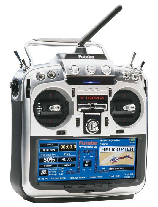

This is the Futaba 18MZ 2.4GHz Computer Radio System on Mode 2 with the R7008SB Receiver.
**Does Not Include Servos**
This is the helicopter version which will default to helicopter settings when powered up.
| FEATURES |
- Futaba's FASSTest technology is fully compatible with Futaba's FASST, and S-FHSS systems
- Bi-directional, full support for telemetry functions
- Internal memory that can be used for sound and picture files
- Dual high-speed processors
- 3-axis gyro remote gain
- Built-in 0.3M megapixel camera
- 640x240 resolution 6" touch screen responds to gentle finger pressure for easy navigation and programming
- Built-in USB Port to connect a memory stick or connect transmitter to a keyboard or mouse or download telemetry data to a PC or laptop for storage and reference
- SD card slot allows even more (and adjustable) capacity for updates model memory and more
- Built-in Serial Interface works like Futaba's stand-alone CIU-2 serial interface for programming the travel, endpoint and other functions of S.Bus and S.Bus2 servos
- R7008SB receiver allows the use of as many or as few channels as needed-operate up to 8 channels using the standard PWM inputs and any servos from simple analog to S.Bus and S.Bus2 servos, or use up to 18 channels (16 proportional, 2 digital) through the two S.Bus2 ports, simple, foolproof setup for S.Bus and S.Bus2 servos
- Adjustable stick angle allows users to customize their control setups for greater ease and precision
| INCLUDES |
- Futaba 18MZ 2.4GHz Computer Radio System on Mode 2 with R7008SB Receiver
- 7.4V 3500mAh LiPo transmitter battery
- Transmitter case
| REQUIREMENTS |
Servos of modeler's choice
| SPECIFICATIONS |
Weight: 1202 grams (2.65 lb.)
Operating System: 2-stick, 18 channels, 2.4GHz FASSTest/FASST/ S-FHSS system
Transmitting Frequency: 2.4GHz
Power Supply: 7.4V LT2F3500 LiPo battery
Current Drain: 1 ampere maximum (RF power on and back light on) 700mA average
| COMMENTS |
Optional multiple telemetry sensors are available; RPM (magnetic and optical) Temperature, Voltage, Altitude, GPS


